Proudly gazing off into the valley, the mighty Skarsfjället makes an impression on all Ramundberget arrivals. Begin your hike from the hotel and enjoy breathtaking views of the valley and waterways on this 35 km trail. True adventurers only!
One or two days?
If you start from Ramundberget Village, you're looking at a 35 km round trip. From the Mountain Parking Lot ("Fjällparkering") by Slättansvallen it is a slightly shorter trip of 30 km total. That's a big walk to do in a day, and a tip is to split it up into two days by camping out in the valley. That way, you can enjoy the splendid scenery without stress. Of course, if you're hiking during early summer, the sun won't set until very late and finishing in a day shouldn't be a problem if you're physically fit.
Finding the Trail
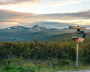
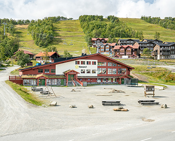
Start from Hotel Fjällgården in Ramunderget and follow the asphalted road towards Skarsfjället. Here, you have two options: either you can take a right after about 200 m, down towards the bridge over Ljusnan River, and continue on the trail leading to "Klinken." Alternatively, continue on the asphalted road for another 3 km, until you reach the Slättansvallen parking lot. (If you have a car, you can choose to drive all the way here for a shorter hike. Remember you need to pay the road toll, either in cash or by Swish.)
After reaching "Klinken," continue towards Gemtour Tvärån. From here, a gorgeous path runs along Ljusnan River, which is eventually crossed by Tvärån River. Follow Tvärån River all the way up to the treeline, where you'll be rewarded with beautiful waterfalls and great opportunities for swimming. Perfect for a picnic break, or a dip on a hot day!
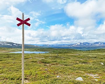
After this, the terrain becomes more challenging. Follow the waterway past the treeline all the way to the foot of Skarsfjället. From here, you'll be able to see clearly what you have ahead of you, as the mountain shows off in all its glory! You are 4 km into your hike, and this is where you finally start to climb uphill. A tip is to enter through the "opening" of the rock massif and walk towards the lake in the "bowl" of the mountain (to your left; watch out, as there are two lakes!). From here, it's easiest to walk along the lake and past the brook towards the top. To avoid very steep terrain with large rocks, we recommend walking "around" the mountain top and completing your climb from the north west side. You're very close now, and should prepare for breathtaking views!
Once you've celebrated your achievement, you walk back down the same way you came up.
Pack Right
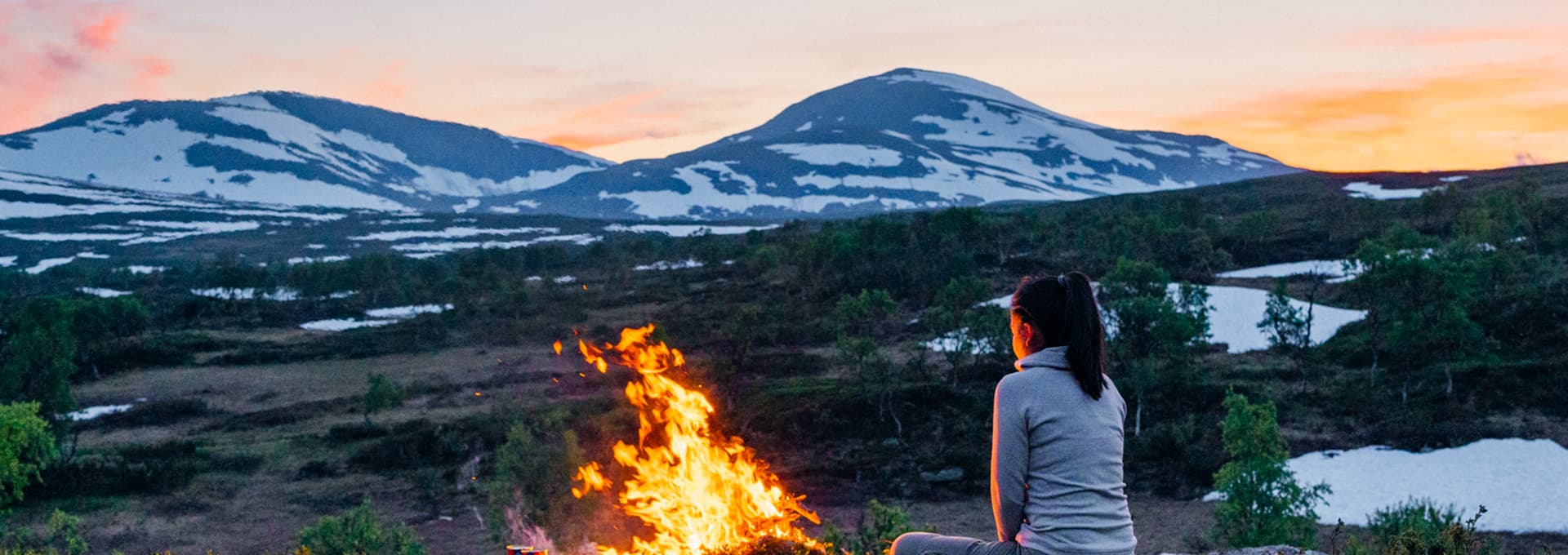
This is a long hike through challenging terrain, with high demands on fitness for those who want to make it to the top. Make sure to pack plenty of energy in the form of food, drinks and snacks. If water levels are normal, you can fill your water bottle from all streams and brooks. We recommend bringing a thermos with hot water, coffee or chocolate on a cold day - once on the mountain, temperatures can drop quickly!
Regarding clothing, the best idea is to bring plenty of good quality layers such as windbreakers and other rain and wind-resistant shell garments. An extra sweather is usually appreciated, as we mentioned it gets cold on the mountain! A thin woolly hat or mittens can help, too. Make sure you've got good hiking boots on, as parts of the terrain can be very wet. Your feet will appreciate the extra support during rocky passages, too!
Map and compass are must-haves, and another tip is to download the ”Fjällkartan” App by Lantmäteriet ("Swedish Mountain Maps" in English).
Other Nice-to-Haves:
- First Aid Kit
- Sunscreen & sunglasses
- Mosquito repellent
- Blister relief plasters (like Compeed)
- Powerbank for you phone
If you're camping out, you will of course need a lot more equipment. Don't hesitate to ask our knowledgeable Topsport staff for more information about camping gear!
Good luck, and have fun!
Length: 35 km round trip
Duration: 15 hours